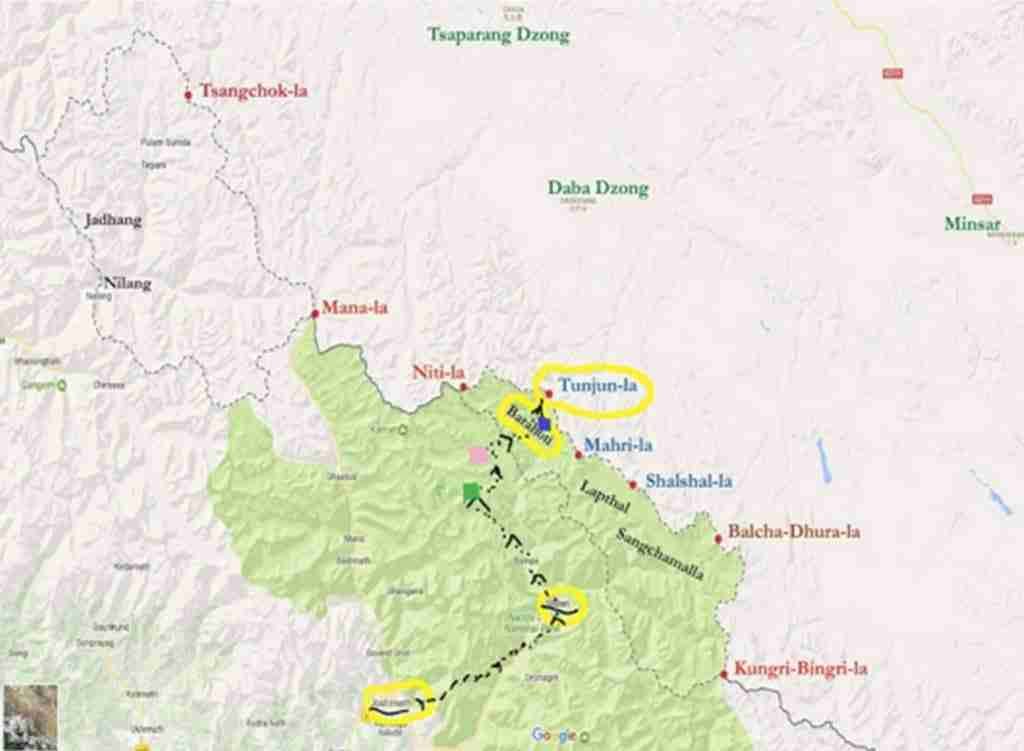
Except for a few bureaucrats and fewer officers of the Army and Air Headquarters in New Delhi, none else would have heard of the place named Rimkin in the “disputed” Barahoti Plain region of India in February 1962. Happily it had fallen to my lot to venture out and explore a plausible route for establishing an Army Post in the vicinity of Rimkin, to oversee and checkmate attempts of the PLA from intruding across the India-Tibet border.
I had barely settled into my second “field” tenure in J &K when I was summoned by my Commanding Officer, Major Shivdev Singh who looked agitated and without ado queried angrily “have you pulled strings for transfer to a ‘peace station’”? But before I could gather my wits he ordered, “Report to Headquarter 9 Infantry Brigade at Lucknow forthwith. Be sure to take the officers’ bus to Pathankot tomorrow morning”.
So in the last week of February 1962, Brigadier Bisheshwar Nath (a burly six foot something with walrus mustachios) showed me a signal from the Army Headquarters marked “Top Secret and Personal for the Commander” directing him in nutshell (i) to occupy a Company Defended Locality at Rimkin the soonest but not later than 15 May, 1962 and (ii) Captain Baljit Singh would command the Special Task Force (STF) till the Rimkin perimeter-defence was effectively established.
Noticing my stricken looks and becoming empathetic the Brigadier mentioned: “young man, I have been informed that you are a fresh graduate from the Basic and Advanced Mountaineering Courses under Mr Tenzing’s tutelage and have requisite knowledge and skills to tackle this assignment. So cheer up and get a terrain briefing from Lieutenant Colonel KM Pandalai (KMP) of the 14 Rajput who has just returned from Joshimath”.
Next, the Brigadier led me to an adjoining room and on a wall covered with maps he placed his index finger on one spot and said, “This is the Barahoti Grazing Ground (BGG) which the Chinese threaten to usurp from India. I have personally handpicked one company of the fittest and highly motivated soldiers of 14 Rajput Battalion, to constitute the STF. Your task lies in inducting them from Joshimath onwards either en-bloc or in driblets across the Chor Hoti Pass, approximately 16,000 feet ASL. You have a carte blanche sanction from the Army Headquarters to hire/purchase specialised equipment, mountain guides, etc., and travel anywhere in the country, to do so” (words to that effect).
Noticing my stricken looks and becoming empathetic the Brigadier mentioned: “young man, I have been informed that you are a fresh graduate from the Basic and Advanced Mountaineering Courses under Mr Tenzing’s tutelage and have requisite knowledge and skills to tackle this assignment. So cheer up and get a terrain briefing from Lieutenant Colonel KM Pandalai (KMP) of the 14 Rajput who has just returned from Joshimath”.
What I learnt next was anything but reassuring. Firstly that there was just one single-lane, 560 km road from Lucknow to Joshimath (last 300 km stone-paved) which under favourable weather was a three day journey for cargo-laden, light trucks. And beyond, a well beaten 80 km pony track to Ghamsali (10,000 ft ASL) and thence pristine, mostly untrodden 40 to 60 km terra firma to Rimkin! Wisely, the Colonel had already commenced shipment of 30 days commodities for the STF to Joshimath.
Preperations and more
What KMP informed me next was the most worrisome aspect of the STF’s capabilities that they had had no previous experience of living and soldiering at high altitudes. If it was a matter of few soldiers to be attuned to operate in a high altitude environment, I could have handled it by myself. But given a large body of 120 and limited time, this vital task was best entrusted to the Ski Warfare School, Gulmarg. The Brigadier agreed readily, organised airlift to Srinagar and exposed STF to a compressed ten days training capsule. He also agreed to establish a forward logistics dump at Ghamsali as an urgent priority.
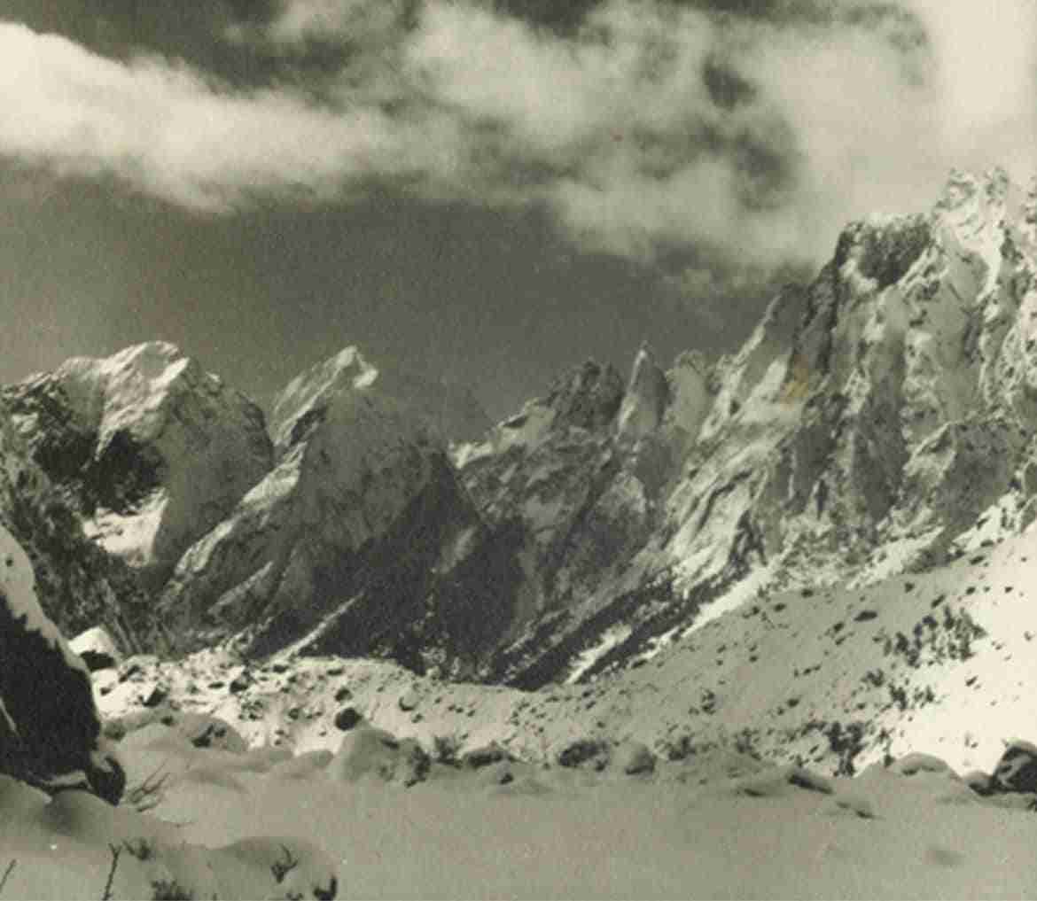
I departed for Darjeeling by the next train and with Tenzing Sahib’s help hired four B-grade Sherpas, purchased such accessories as charting a route over the Chor Hoti Pass may require, and together with the Sherpas set out for Joshimath. We preceded the STF by four days for a fast foray to Rimkin and back. The approach to Chor Hoti Pass lay through a narrow horse shoe, with ten to fifteen feet deep snow pile. Once the sun touched the area, the ascent was very exhausting, even for seasoned climbers.
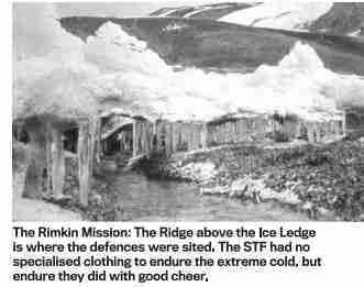
The descent on the far side was down a near vertical rock face and we set to fix a Manila-hemp rope for two hundred and forty feet on the steepest stretch. The going beyond for about three kilometres was over an almost level, snowed up plateau, ending at a wet and dangerously slippery rock ledge. Here again, two rope hand-rails were fixed for two hundred and fifty feet, ending close to the spine of the Rimkin ridge, our ultimate goal post! We bivouacked for the night, unarmed and taking comfort that the Brigadier did not expect the PLA to show up before mid May!

Meanwhile, as planned, Captain R.S. Taragi (Rajinder) had moved to Ghamsali with the STF and commenced stocking ten days worth rations at Kala Zabar (12,600 ft ASL), about 10 km enroute Chor Hoti. We decided to make the first push with 30 soldiers, leaving Kala Zabar at 2300 hrs, on April 21, each soldier carrying personal kit and two days survival rations. The snow on the approaches to Chor Hoti was firm and compacted by night but laden with 30 kg, the going was slow and laboured. At 0400 hrs on 22 April, all of us were atop the Chor Hoti saddle.
The descent using fixed ropes was a new experience for the soldiers and almost all of them had to be led by us in relays, one by one. In the event, the last man reached Rimkin at 1845 hours on 22 April 1962 and in so doing consolidated India’s claim on BGG. In truth, I must admit that the soldiers were so exhausted after the 12 to16 hour long very demanding day (a few even hallucinating “kiya hum Tibet pahunch gaeya Saab”) that they could have been taken hostages without a murmur, at the mere asking.
The descent on the far side was down a near vertical rock face and we set to fix a Manila-hemp rope for two hundred and forty feet on the steepest stretch. The going beyond for about three kilometres was over an almost level, snowed up plateau, ending at a wet and dangerously slippery rock ledge.
We were given a radio set of American origin with independent power source which had to be cranked manually by two men for the duration of the transmission. But it worked! We communicated the code of having touched base at Rimkin and air-drop of tentage, fuel and basic food.
At this stage, I got into a huddle with Rajinder, the Sherpas and two Radio operators to organise our soldiers into three groups of ten each, prod them to erect the ten two-men tents we had carried and generally keep them moving about. The Sherpas also lit three stoves and set about brewing three langar-degchis of extra sweet tea! Half a mug of warm brew and shakar-paras helped lift spirits all around and avert looming disaster from dehydration etc.
The PLA factor
There was no acknowledgement of our radio message but on 24 April, we were awoken by the drone of air-craft over Rimkin. In the next twenty minutes two Dakotas dropped cargo, creating a cloud of floating white parachutes over Rimkin. The “drop” had spread several hundred metres all around, which combined with the fatigue factor and parachutes merging with the snow, we could detect and retrieve only about twenty per cent of cargo.
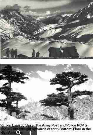
The Sherpas and I now guided the second batch of fifty STF soldiers from Kala Zabar to Rimkin. Accompanying this batch were also fifteen Constables of the UP Armed Constabulary who were to set up a Revenue Collection Post (RCP) from the graziers in BGG. In time, the STF “Defended Locality” was sited about two km ahead of Rimkin on a flat ridge with a commanding view over BGG right up to the International border.

And on 29 April 1962 the Indian National Flag was hoisted at the RCP with full military symbolism, including a bugle-call and smart salute by the STF! Henceforth, the Tricolour was unfurled at Reveille every morning.
The BGG is a gigantic amphitheatre (three times the Lutyen Bungalow Zone) of 13,500 ft mean elevation, with ridges one to three thousand feet higher than the BGG plateau-floor. But its North-East rim, which forms the international boundary with Tibet (China) is barely five hundred feet higher than the BGG, making Tun Jan La (14,500 ft ASL) a convenient gateway to Bara Hoti Plains, for the PLA.
The eyeball to eyeball moment occurred at 1045 hours when the PLA detachment’s repeated attempts to bypass the RCP was physically blocked by us, all the while drawing their attention to the fluttering Tricolour.
On 12 May 1962, our Observation Post reported men and ponies descending Tun Jan La, about two hours walking time from us. At last here was the PLA detachment of twenty soldiers with thirty laden ponies on course to Rimkin. We had time to deploy our six LMGs, two MMGs and assemble the remaining 65 soldiers with bolt action rifles, fixed bayonets and charged magazines near the RCP in a show of strength. No one had given us any orders in the event of a show down and far flung as we were, our strength lay in instinctive actions.
The eyeball to eyeball moment occurred at 1045 hours when the PLA detachment’s repeated attempts to bypass the RCP was physically blocked by us, all the while drawing their attention to the fluttering Tricolour. After a few minutes of heated gesticulations, and noticing our numbers, they retreated by about hundred metres and pitched their tents inside an abandoned stone-walled enclosure of the graziers. We offered them a kettle of hot tea but they refused it out of hand. Sadly for the RCP, the thirty ponies of the PLA were the only livestock that pastured in the BGG and they refused to pay the revenue!

The Tun Jan La is also the origin of a stream which flows past Rimkin and ultimately drains into the Dhauli Ganga near Malari (midway Joshimath enroute Ghamsali) thus leaving no doubt that Tun Jan La is the watershed ridge, per se. The Sherpas and I walked down this stream for about four kilometres and felt that a mule track (ultimately a motor-able road) linking Rimkin to Malari may be possible and thus provide an all year access to Rimkin by avoiding the Chor Hoti obstacle in the future, altogether.
When a month later, I was debriefed by Maj Gen D K Palit, the Director Military Operations, he accepted and got implemented my recommendations of road to Rimkin as also parachutes in red and orange colours for use in snow bound areas.
On 14 May, the STF hosted the Sherpas and me to “Lunch Bara Khana” and waved us off with full throated war cry of the Rajputs “Bol Bajrang Bali Ki Jai”! We had hoped to spend time at Ghamsali** for bath and change of clothes, first in six weeks, but found seven ponies and a note to reach Joshimath, two days hence. Brigadier Bisheshwar Nath and Colonel K M Pandalai broke with Officers’ Mess protocol, ushered the Sherpas and me in the same clothes, to a sit down dinner and in warm bonhomie gifted me a Rajput Regiment memento with a touching inscription: “…for his immemorable service in establishing Rimkin, 20 April 62”.
As I recall the mission, I get goose bumps. What if the radio set had got damaged or if the weather had prevented air drop of food and tentage? We were simply lucky!
“…Captain Baljit Singh was awarded The Chief of Army Staff Commendation Card for gallantry and distinguished service for his excellent… at Bara Hoti, 17,000 ft… by Major General DK Palit, Vr C”.
Post Script
** Ghamsali had first seen Indian Army boots back in 1952 when Major General Harold Williams, the E-in-C had conceived and led a Sapper Expedition to Kamet (25,446 ft) and put Captain ND Jayal with two Sherpas on the summit. The E-in-C superannuated as Lieutenant General Sir Harold Williams and Major Nandu Jayal became the first Principal of the Himalayan Mountaineering Institute, Darjeeling.
However, Kamet was first summited by a Swiss, Frank Smyth in 1931 and who on the return to Ghamsali decided to explore the surroundings and literally stumbled upon the since famed “Valley of Flowers”.


